- Home
- / Services
- / 3D laser scanning
/ˌθriːˈdiː ˈleɪ.zə ˈskæn.ɪŋ/
3D laser scanning uses high-precision laser equipment to capture millions of measurements across a site or structure. The result is a detailed digital model or point cloud, providing highly accurate data for design, analysis and construction planning.
What You Receive
Depending on project needs, outputs can be tailored to suit design, analysis, or record‑keeping:
- 2D drawings — plans, elevations, and sections derived directly from the point cloud.
- 3D models — from simple massing models to detailed BIM‑ready geometry.
- Point cloud datasets — supplied in industry‑standard formats for direct insertion into CAD or modelling software.
This combination of high‑accuracy capture, safe working practices, and flexible deliverables makes 3D laser scanning one of the most powerful tools for modern surveying.
This combination of high‑accuracy capture, safe working practices, and flexible deliverables makes 3D laser scanning one of the most powerful tools for modern surveying.
Our Expertise
3D laser scanning
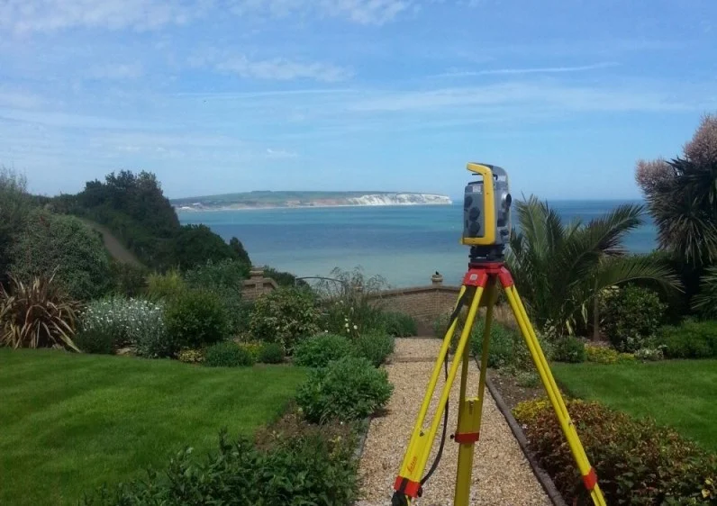
3D laser scanning provides a fast, highly accurate way to capture the full geometry of buildings, structures, and environments with minimal disruption. Using our Trimble X7 laser scanner, we collect dense point‑cloud data that records every visible surface in exceptional detail. This approach is ideal for projects where precision, safety, and efficiency are essential.
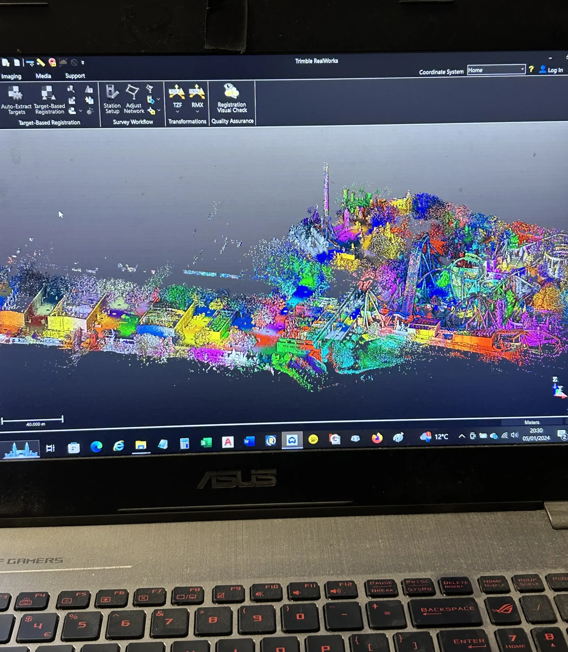
All scan data is processed through Trimble Business Center, Trimble RealWorks, and BricsCAD, ensuring clean, reliable outputs that integrate seamlessly with your design workflow. Deliverables can be supplied as 2D drawings, 3D models, or the full point cloud ready for direct use in CAD or BIM software.
Where 3D Laser Scanning Excels
3D scanning is particularly effective in environments where traditional surveying methods are slow, disruptive, or unsafe. Key applications include:
Street and highway environments — remote capture allows us to survey road corridors, street furniture, kerbs, and surrounding features without the need for traffic management, reducing cost and risk.
Building defect analysis — cracks, distortions, misalignments, and other defects are clearly visible within the point cloud, supporting condition assessments and refurbishment planning.
Difficult or dangerous access areas — confined spaces, plant rooms, roof voids, and inaccessible roof areas can be surveyed safely from the ground or a secure vantage point.
Complex structures — irregular or detailed architectural features are captured with full accuracy, removing guesswork and reducing the need for return visits.
Heritage and conservation — non‑contact scanning preserves fragile structures while providing a permanent digital record.
Why Choose Us
Accurate Surveys. Reliable Service.
We provide professional land surveying services built on accuracy, clear communication and dependable results.
Our surveys are completed using advanced technology and industry expertise, allowing us to deliver accurate and detailed results suitable for planning, design and construction.
We provide straightforward quotations and transparent pricing, ensuring clients receive professional surveying services that offer genuine value without compromising quality.

Trusted by world-class business and organisations of all sizes